Whilst mulling over these words, a memory surfaced from my childhood. I'm not sure exactly how old I would've been, but I recall a large (at least to a small child) map of the world, spread out on the lounge floor. Mind you, back then, it wasn't called a 'lounge', it was the 'kitchen' (the actual kitchen was called the 'back kitchen', go figure). That aside, with a big map and a floor, a game ensued. My parents and I took it in turns to find features or places on the map and give cryptic clues for each other to work out. Dad would routinely deliver clues with terrible puns, and, yes, it is highly likely that my love of maps and awful puns dates from this time.
Growing up, hiking through the dales and over the fells of the Pennines, we (family or friends) were never without an Ordnance Survey map, although it must be pointed out that this isn't the same as never becoming geographically-challenged.
Over the years, I haven't travelled a huge amount, but have always collected maps of our destinations which, due to repeated visits, have become very well-used.

The orange 1:25000 Explorer series side of the shelf has slowly grown larger than the combined pink 1:50000 Landranger and green 1:10000 Pathfinder series side. There's even one old Bartholomew 'Half Inch' series represented, bought second-hand to show where we lived in Milton Keynes, but from a time before a city of 250,000 inhabitants existed.
But going back to my younger days, once my interest in motorsport was kindled, it wasn't a huge leap to have a go at rally navigation, initially on closed stages then, later, on road events. Route instructions can come in many nefarious forms, but the most familiar will probably be Tulip diagrams (named after the Tulip Rally in the Netherlands where they were first commonly used). In essence, each pictogram represents a junction on the route, with the dot being the approach direction and the arrow being the departure direction.
Here's an example from a small club event which I had the pleasure of organising, showing the route between two Time Controls. Note that although the numbered boxes begin and end in sequence, that isn't true for the whole table. See, definitely nefarious.

Worse still, are Herringbones. In principle, these are quite straight forward, simply showing the route as a straight line, with the unwanted turnings as short lines on the right and the left.

The above example isn't quite so straight forward, as the Start dot is on the right. However, reading from the dot, the instructions are: turn right, turn left, turn left etc. Or to put it another way: miss a left, miss a right, miss a right etc.
Herringbones have developed a fearsome reputation because they are often represented as a circle, which isn't so bad if you know where the start or finish junction is located. But if you don't know, or are unsure whether it's going clockwise or not, or even whether it's a mirror image, then they're definitely hellish.

These sorts of route instructions have to be transferred to a map, ideally before the driver needs to know, but sometimes it isn't possible to plot beforehand. Here's an example of a hastily-scribbled route, pencilled onto the map as arrows cutting through the unwanted turnings.
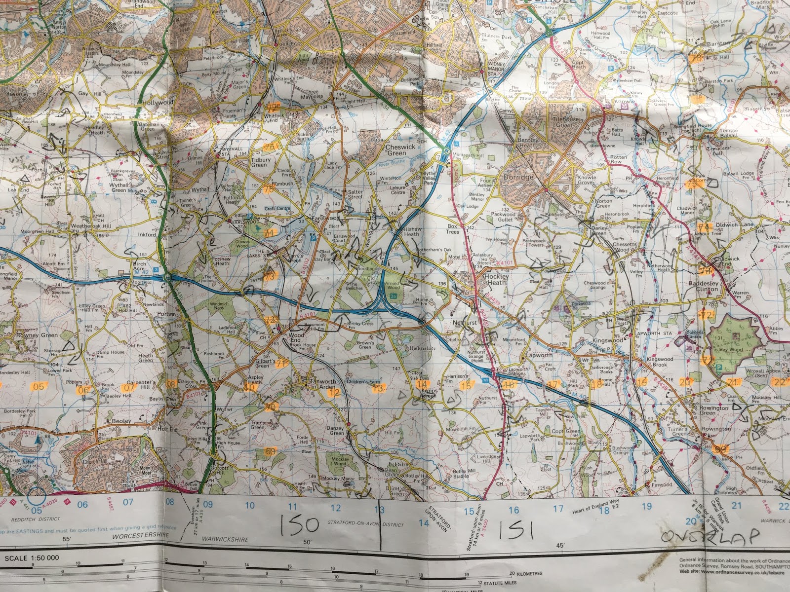
The eastings and northings numbers were highlighted beforehand to help with the plotting of grid references under pressure.
When we lived in Germany, I really enjoyed using a different type of map. Same scale, but a very different way of describing the terrain and features.

If all this sitting around in vehicles seems a bit... well... lazy, at least from a physical, if not from a mental point of view, then never fear, there was lots of orienteering too.
Often described as 'cunning running', this sport combines a cross country run with a navigational challenge. The trick is to find the quickest time between the checkpoints, which will not be the shortest route due to the nature of the terrain and vegetation. Counter-intuitively, green on an orienteering map is a landscape you have to fight your way through.

Again, there was plenty of opportunity to engage in this pursuit when we lived in Germany, though, thankfully, there was an international standard when it came to describing the vegetation.

Once I had hung up my compass and bramble bashers (orienteering) and map magnifier and sheets of acetate (navigating), Life became much quieter. These days, I only wrestle with grid references when I'm recording wildlife sightings. And although we live in a bungalow, I still have to remember 'Along the hall and up the stairs', the mantra for plotting the eastings first and then the northings.
1 comment:
Well you've got me completely lost!
Post a Comment